


Avvir Case Study
360º Site Photos, Pinned to the Floor Plan
Avvir is a New York construction-technology company. Its software compares scans of a building under construction against the design model, so builders can track progress and catch deviations early. In 2019, co-founder and CEO Raffi Holzer and Cory M Burnett, who led the product work, brought Blood & Treasure in to add 360º site photos to Avvir's web viewer.
Challenge
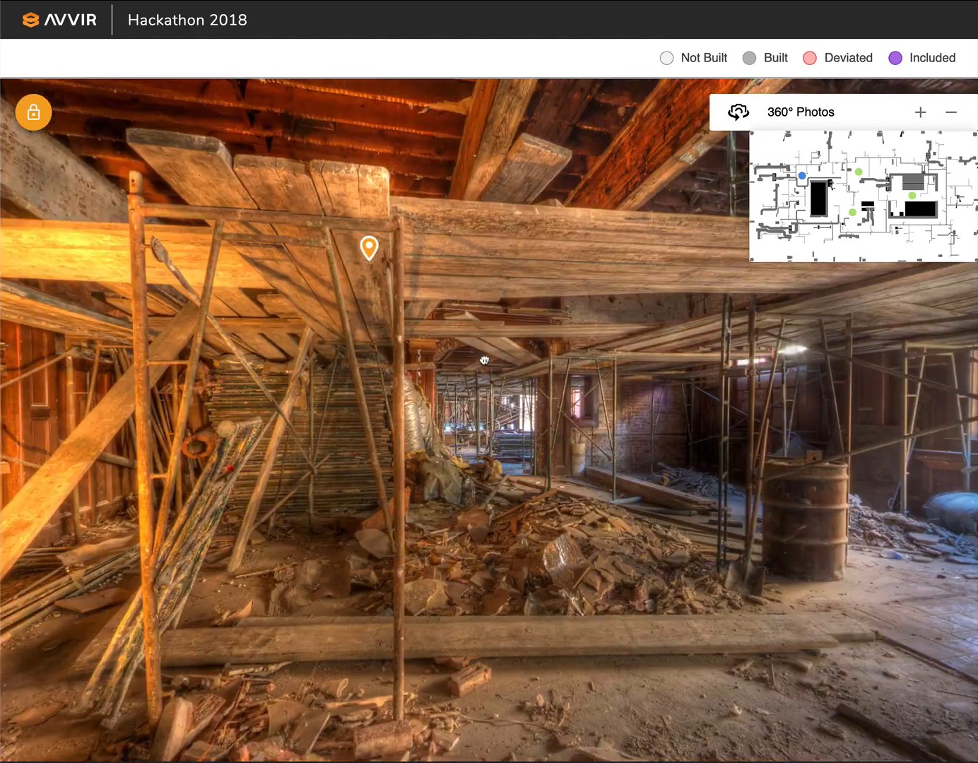
Avvir wanted a project manager or superintendent to be able to open a 360º photo from the floor plan, look around the space and drop an observation on the exact spot that needed attention, with a title, a comment thread and an author.
Avvir's own engineers were busy with the core scan-processing and API work. They needed a team to build the front end of the 360º experience inside their existing React codebase while they built the matching APIs.
After walking through the designs with Raffi and Cory in May 2019, we reviewed the codebase and the backlog and scoped the work: a floor-plan minimap, photo markers on it, a full-screen 360º viewer with zoom and rotate, and observations placed in the photos.
Development & Implementation
What We Built
- 360º photo viewer. A full-screen panorama viewer built on Three.js and embedded in Avvir's React web app, with drag-to-rotate, scroll and button zoom, and a lock mode that holds the view steady while you read pins.
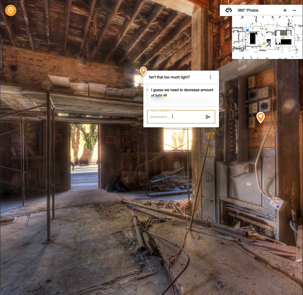
- Observation pins. Clicking anywhere in a photo drops a pin and opens a title and comment dialog. The pin stays fixed to that point as the user rotates and zooms.
- Comment threads. Each observation holds comments with their author and date, loaded alongside the observations from Avvir's API.
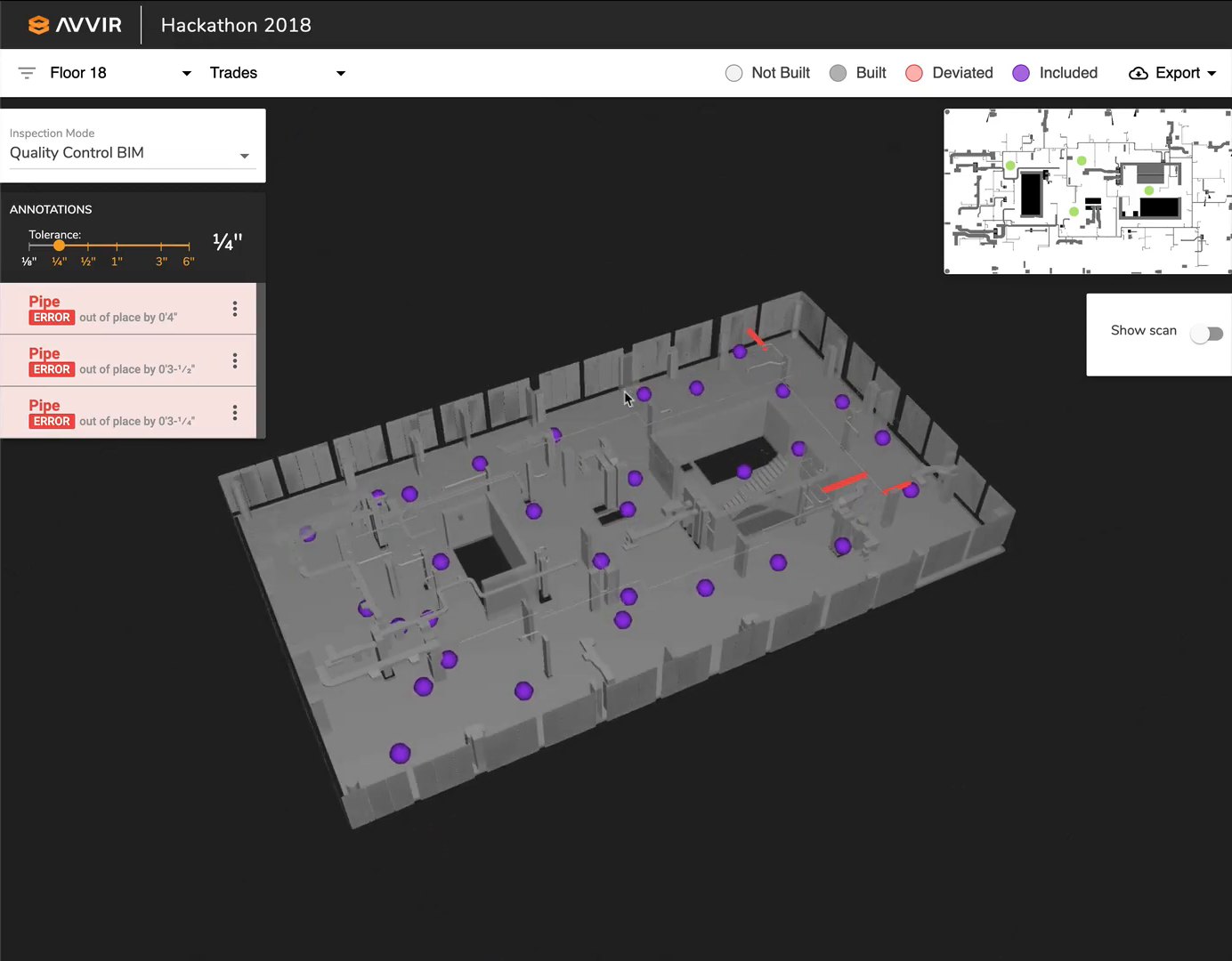
- Floor-plan minimap. A collapsible, zoomable and draggable minimap shows where each 360º photo was taken. Clicking a dot jumps to that photo.
- Cube-map panoramas. The viewer started with single-image panoramas, then added six-face cube maps when Avvir's real capture data arrived in that format.
- API integration. The viewer is wired to Avvir's 360º image, minimap and observations endpoints, and we worked with their team on the API's shape.
- Customer demo. We deployed a working prototype so Avvir could show it to a customer ahead of the full integration.
How It Works
Panoramas in Three.js. Each 360º photo renders as a texture inside a Three.js scene, embedded as React components in Avvir's existing web app.
Pins in 2D and 3D. When a user clicks, the viewer converts the screen position into a point on the panorama image and into a direction in 3D space. Both are saved with the observation, so pins render in the right place without recalculating, and the same data can later be shown on the 3D building model.
Built ahead of the API. We first built the components on a test route with sample data in the shape of the planned API, which kept the work moving while the endpoints were finished. We then moved them into the project viewer and pointed them at the live endpoints.
Handed over cleanly. We delivered the code as branches and a pull request on Avvir's GitHub, with fully specified stories for the next phase, and Avvir's team took over the final integration.
Results
We took the 360º viewer from kickoff to a working prototype in about nine weeks, from June to early August 2019. Avvir showed it in a customer meeting that August.
All code was in Avvir's repositories by September 2019 for their team to finish the integration. Avvir was later acquired by Hexagon.